Traveling to Devil’s
Postpile during the busy summer season, requires use of a shuttle bus system.
The shuttles are a good idea – the road into this area is one lane and winding,
going over the Sierra Nevada Mountains, and down the western slope of the mountain
range.
The shuttles reduce vehicle
travel for day users and help conserve a wilderness area. The bus system
operates daily, with frequent departures during the day and only charges $7
(adult), which is a bargain. We caught the shuttle at the Mammoth Mountain
Adventure Center (ski area).
Along the way into the
Devil’s Postpile, there are several other shuttle stops, for visitors going
into campgrounds, to lakes, and trail systems (several leading into the Ansel
Adams Wilderness area).
And, past the
dropoff for DPNM, other popular stops are the trailhead to Rainbow Falls and
Red’s Meadow Resort (trail rides, cabins, café and store).
We decided to take the
shuttle to the Devil’s Postpile stop where we checked out the small Ranger
Station, and began our hike to the postpile and then on to Rainbow Falls. This trail often was close to the Middle Fork
San Joaquin River .
Within about ½ mile the
Postpile came into view. What a unique
rock formation.
Interpretive information
describes this as a columnar balsalt formation.
The vertical columns are mostly hexagonal-shaped, which allows a strong,
interlacing support system for the structure.
The Devil’s Postpile was exposed by glacier action during the last glaciation
period.
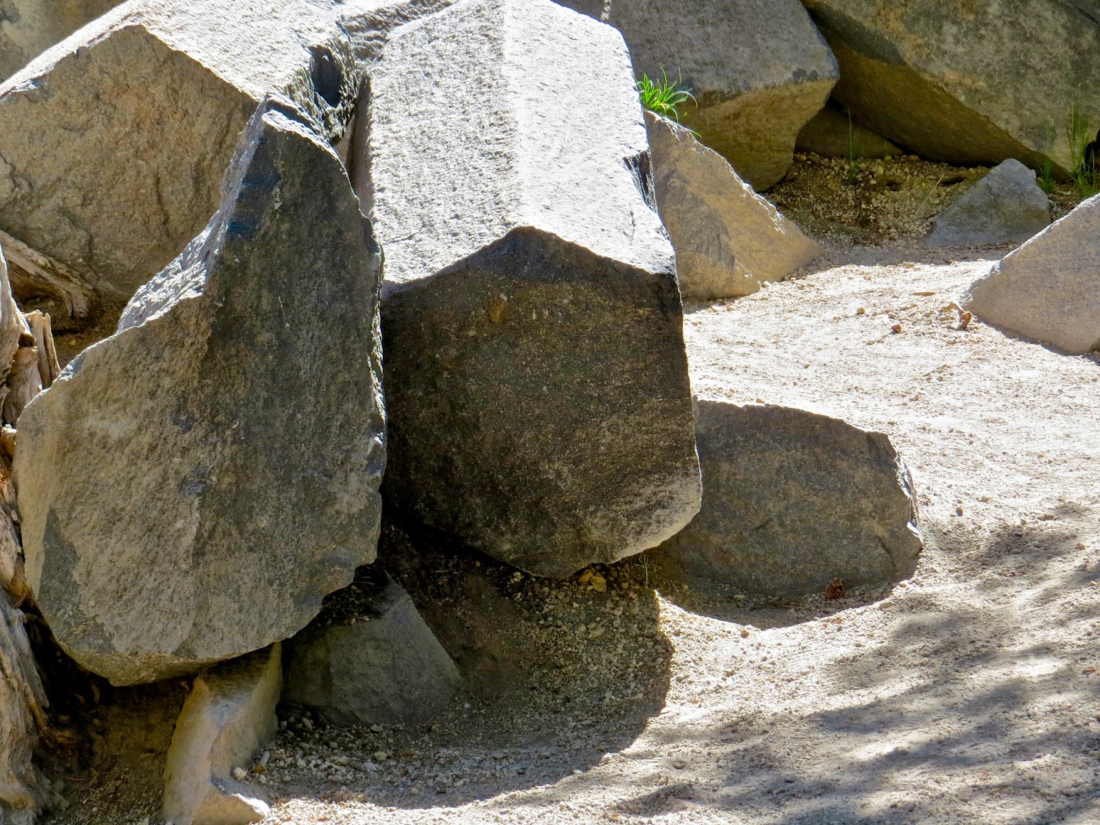
Some of the columns had fallen, leaving a ends where we could see the geometric shapes
A little history - The DPNM
was established along with the Yosemite NP, lost its NP protection due to local
mining interests in the early 1900’s and then President Taft (listening to
activists concerns on protection of the watershed) again placed the postpile
and Rainbow Falls under federal protection.
Today the DPNM is protected within the Ansel Adams Wilderness
(1984).
This fern was emerging out of the "rubble" pile above - so green and beautiful!
Continuing our hike a couple
more miles, we reached Rainbow Falls.
Dropping 101 feet, the falls are spectacular. However, when we reached the falls (late
morning), the sunlight angle was not right for rainbow reflections (giving the
falls its name). But it was well worth
the trip. Below the falls were a couple
fishermen, and some families cooling off in the river.
These falls are also the
result of volcanic activity (after two months in the Pacific NW, I am seeing
the seismic and geologic pattern!).
Looking at the falls, there are two types of rock, stacked one over the
other. The upper layer, is volcanic
andesite (“nickpoint”). It erodes more
slowly than the lower layer of volcanic rhyodacite. So, as the lower layer erodes more rapidly,
undercutting occurs and the nickpoint eventually has no support and drops into
the pool below the falls.
These two different
formations are easily seen looking at the falls; note the ongoing erosion of the lower layer above.
This has happened repeatedly
over time. The information states that
the waterfalls have been moved 500 feet upstream due to the repeating erosion
effects.
Above us was the chatter of
a Stellar Jay, seemingly trying to chase out the biped visitors from its
territory.
We relaxed and watched the jay for a while and then began the hike up to the Red Meadows Resort shuttle
stop. This was the most difficult
portion of the ~4-mile hike. The mid-day
sun was hot and we had little shade due to a fire in the 1990s. Trees are beginning to recover the damaged
forest, but it’s a slow process.
Resting and watching this
wilderness area out the shuttle windows on the return trip, gave me time to
think, process and appreciate having lands such as these protected for all
visitors. Yes, there were many, many from
other countries getting out and seeing America.
The question is – how many Americans just take these protected lands for
granted and never make the effort to see them?
We are ending our time now
in Mammoth Lakes, and also coming close to the end of this, almost 3-month RV
trip. We consider the trip stop to Mammoth Lakes well worth it!


You guys are becoming quite the hikers!
ReplyDeleteHave a safe trip home. Hope Gary is feeling better.
Gayle
We are now discussing hiking areas near home; want to not just make this an "on the road" activity .
Delete