We spent the first few days
of July at the Diamond Lake RV Park, chosen due to its’ proximity to Crater
Lake NP. We soon discovered that almost
all of our time while there was spent exploring the park. And, we also found that Verizon service in
the park was nil, and in the RV park very limited and slow connections, so now
we’re working to catch up a bit.
I don’t think we really knew
what to expect at Crater Lake – a big lake in an old volcano crater; what was
the big deal? Well, at least we could go
see it while in Oregon and cross it off our NP list. So, so naïve!
 But, we did head to the park
soon after getting settled in RV park (just to drop by the visitor’s center and
get some reading materials, watch the info movie, etc.). This NP is in a remote area – not really
uncommon for NPs, but it’s location seemed even more secluded with the long
drive through snow-covered slopes and hillsides.
Yes, snow in July – a new
experience for me. But we were driving
at elevations around 7000’.
And then we finally came to
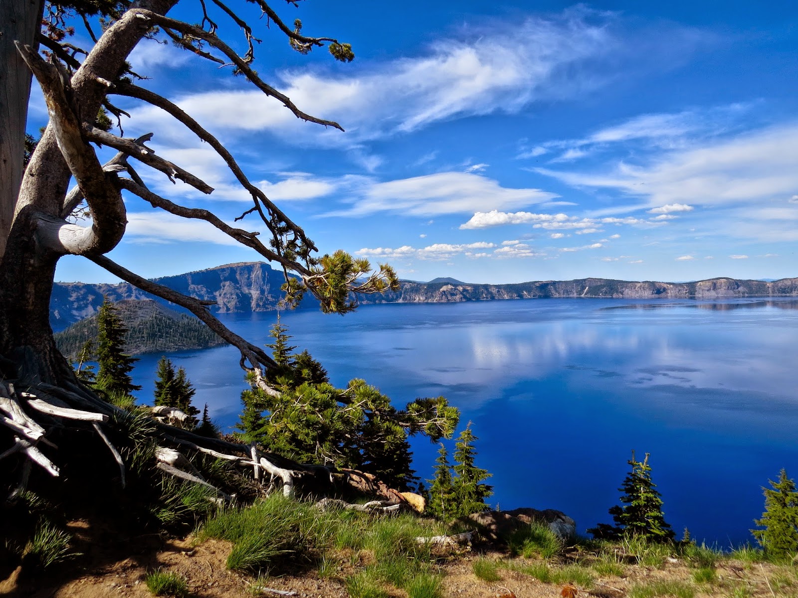
the crater loop road and our first overlook pullout. OH MY GOSH!!
All thoughts of going first to the visitor’s center disappeared. We were both amazed with the size, and deep blue color of this lake. Gary declares this his all-time favorite NP (due, partially, I am sure to the great photo opportunities).
Eventually, we did get back
onto the loop road (the major roadway in the park) and made it to the Steel
Visitor’s Center. There we talked to the
rangers, watched the 22-minute video and left with lots of information and
desire to see MORE.
We learned that Mt Mazama, a volcano with
400,000 years of eruptions which
built it up to a height of around
12.000’, had a major eruption about 7700 years ago. The force of that eruption emptied a huge
chamber of magna, resulting is the collapse of the top of the volcano forming
the empty chamber (crater or caldera).
Over the next several
hundred years, the lake formed from snowmelt and rainfall. No water enters the lake from outside rivers
or streams, so the water is extremely pristine (very clean and pure). The lake measures 6 miles across (maximum)
and 4.5 miles minimum.
 The blue color of the water
is due to the cleanliness of water and the fact that human eyes see the blue
wavelengths scattered in the lake (though other wavelengths are absorbed in the
water). No, that is NOT the sky in the picture on the right. It is the water (photograph only slightly adjusted for exposure).
We noticed that the shades
of blue vary with the depth of the water.
Measurements have been taken at various points in the crater, with
approximately 1-2% of the lake bottom measured. The deepest point is 1943 feet.
Several methods were used for these measurements over time including the use of
a small one-man sub! Also, the rim height is not
uniform, but varies from 507 feet above the lake surface to 1978 feet.
Before, we had planned a day
or so at the NP and check out some other local points of interest around the
area. We ended up spending three days
exploring in the park, and only saw a small portion of the park.
The park was well organized with lots of space for stopping to view the sites from the edge of the caldera. The park was also very concerned about those visitors who were logically challenged and ventured close to the edge.
With so much to see and do,
we’ll have more information on the next post.


Will never forget that first view of Crater Lake. Absolutely stunning! Prettiest lake we've ever seen.
ReplyDeleteGayle