
On our last day in the Moab area, the weather
cleared in the afternoon and we headed back to Arches NP for a final hike. This
time we wanted to try the 2 mile (round trip) Park Avenue Trail.
It was rated a moderate hike, steeply
descending 320 feet into the wash, leaving from the trailhead and walking
toward the Courthouse Towers formation.
Of course, that meant an uphill climb on the return portion.
 |
| Beginning the descent |
I have been wondering how these formations and
trails within Arches received their names.
Some are fairly easy to understand, and others, like naming this canyon
“Park Avenue” left me a bit bewildered.
But it is a beautiful hike.
Signage at the trailhead provided a summary of
the past geologic events that led to what we were about to see. After several days in this park, I
appreciated this concise overview of a long, long history leading to the
wonderful arch formations found here. [Much more lengthy geologic information
was available in the visitors’ center.]
 |
| Note the 3 types of rock and the descriptions below |
This section of the sign identifies the 3
distinct types of rock found in the canyon sides.
#1, “Moab Tongue” is the top, and youngest
layer of rock. Its a light-colored rock, which has almost entirely eroded away.
Formerly about 1 mile thick, this rock layer compressed layer #2 into
fine-grained, cliff forming, sandstone.
#2, “Slick Rock Member” is the middle layer
(formed over 150 million years ago) and is Entrada
Sandstone. This rock dominates the park and is prone to arch formations.
Over the past 2 million years, erosion of cracks in this layer created tall,
vertical slabs (called fins; the 1st step for arch formation). This
layer was very evident in the walls along our walk.
#3, “Dewey Bridge Member” is the oldest layer,
appearing reddish-brown, and appears somewhat muddy/lumpy (remains of a tidal
flat environment).
 |
| Note the large sandstone slabs and lower, older rock |
 |
| Notice of trail marking system |
 |
| Here we are at the first cairn; all are not so large |

I stayed
busy checking out the spring blooming flowers and shrubs


Gary was busy finding the best photo op – often
using the pools formed by the recent rains as foreground for the rock
formations.


 |
| Drat - the uphill part! |
After enjoying all the great formations - it was time to head back up the hill
We prepared to leave this wonderful park a little sad – and then to the SE the cloud cover departed from the La Sal Mountain peaks. How could you be anything but happy with such a beautiful sight?
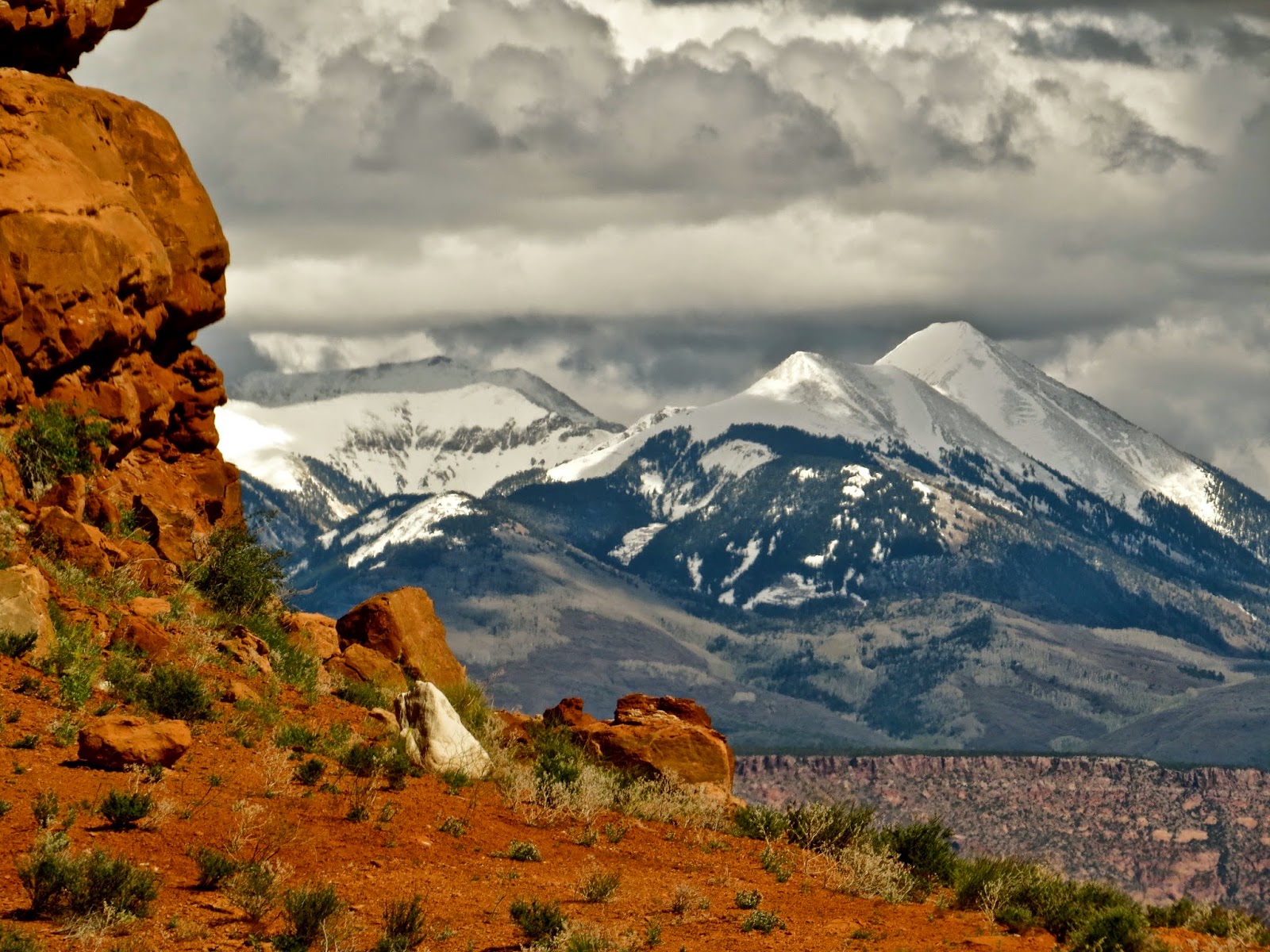 |
| View as we departed trailhead and drove back toward Moab |
Gary is already planning ahead for another trip
to Arches NP. Too much to see in
one trip!
No comments:
Post a Comment